
CALIFORNIA CONDOR
birdfotos.com
FREE BIRD
Refers to the freeing of 7 California Condors.
On February the 16th. 2002 at 11:00 AM
As approximately 150 birders looked on through binoculars and viewing scopes of all sizes and powers.
The Peregrine Fund released 7 young California Condors and one older adult California Condor.
https://www.peregrinefund.org/index.html
Also I will show you some of the other birds I encountered along the road to view the Condors.
Where did this happen you ask?
High atop the West End of the Vermilion Cliffs in Northern Arizona.
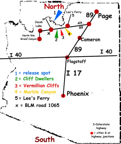
Number 2 is where I stayed, it's 18 miles East of the BLM road 1065. I believe they will release more birds in the fall of 2002, so, if you would like to go and view the release I will tell just how to get there.
You should click on this link and go the Peregrine Fund and ask them when.
Here is the link, https://www.peregrinefund.org/index.html
Regardless if your coming from the North through Page Arizona some 24 miles, or from the South from the Flagstaff area some 100 miles, you will have to turn West on to State route 89A
You will stay on State road 89A until you get to the BLM road 1065 North.
Going West on State road 89A you will first come to Marble Canyon (#4) where the Lee's Ferry turn off is. You should be looking at the bridge across the Colorado River.
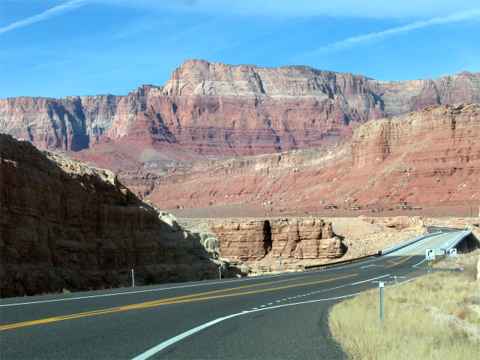
Approaching the Lee's Ferry bridge on 89A.
Continuing on West the next sign you will see is the Vermilion Cliffs (#3), Next will be Cliff Dwellers (#2). Each of these places have a motel and a restaurant.
Continuing on West from Cliff Dwellers it is 18 miles by my speedometer or odometer.
If you zeroed your mileage gauge you should see a Historical marker at 10 miles. At 15.4 miles a bridge.
At 17.5 miles & mile marker 565 is a chain up pull off on your right. At this point you should be able to see a house and other buildings on your right about 1/2 mile ahead of you.
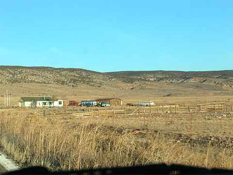
It's the only cluster of building along the the highway you see.
This photo was taken from the chain up area looking West down the road.
At that house is the BLM road 1065 and you will turn to your right or North.
A soon as you turn North this is what you should be seeing.
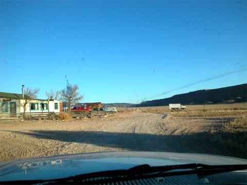
Now your headed North on BLM road 1065.
Just ahead is cattle guard and a sign that reads.
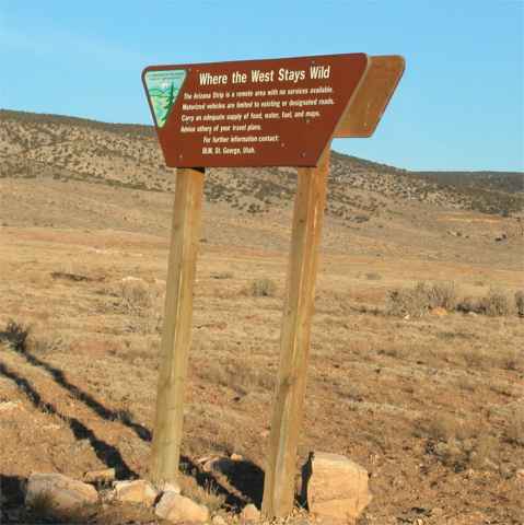
On your left just after cross over the first cattle guard.
The viewing or release site is approx. 2 miles a head on the right side of this washboard road.
I have named this road Stony-Washboard Avenue. Any automobile can drive down it, but slowly.
At about a mile and a half you cross over another cattle guard. Just as you come to the third cattle guard the viewing site will be on your right.
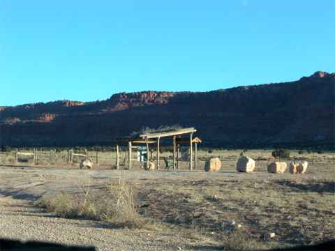
At 7 AM that Saturday this is what the site looked like.
I was a trifle early but this assured me of the choicest viewing spot.
For you GPS people the location is,
36 degrees 46.225' North
112 degrees 03.346' West
*****************************
But by 8 AM the crowd started to gather.
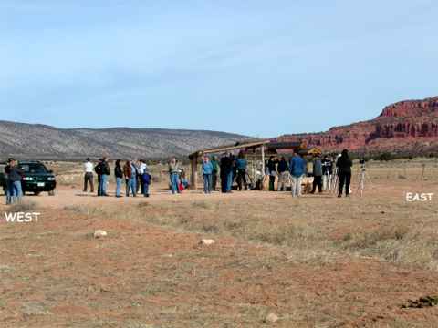
As you can see it was an unusually clear, calm, and windless morning.
However, they aren't wearing those coats & hats because it was warm.
The birds will be released from atop of the cliffs on the right.
By 10:30 the crowd was much larger.
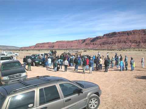
Here the Peregrine people were introducing their people
and telling the viewers where to look and what they could expect to see.
The viewers were coming in by the car load. In all approx. 150 plus birders were there before the release.
***********************************************************