
This web site contains photos of the following.Birds,arizona birds,wild birds of arizona,Hummingbirds, Arizona desert life,flowers plants,trees,cactus,blooms,cicada,locust,frogs,tortoise,snakes,moths, butterflies,wolf,lizard,peccary,javelina,coyote,dinosaur insects,fox,grasshopper,hawks,larks,sparrow,warblers,jays,tanager,wrens,robins,grosbeak,hummingbirds,woodpeckers,verdins,phainopepla,blackbird, bunting,ducks,finch,doves,flycatchers,gnatcatchers,kinglet,oriole,owl,pyrrhuloxia,quail,rail,sniperoadrunner,thrasher,thrush,titmouse,towhee,trogon,vireo,vultures and much more,museum,water,Arizona desert,deserts,mountains,
birdfotos.com
HELL?
I'm not ready to go there just yet.
Maybe it's only a dream and soon I'll wake up and all will be OK.
***************************************************************
OK, here's what happened.
First, packing my ole van with good stuff, candy bars, pop, chips & all that good ole health food items you know.
Taking off, or out on one of my spontaneous bird foto trips, west to California on I-8. I decided to turn north on highway 86 at El Central, preceding north through Imperial, Brawley, and on to Calipatria and then it happened.
Looming directly at me along side the road was this round very tall structure.
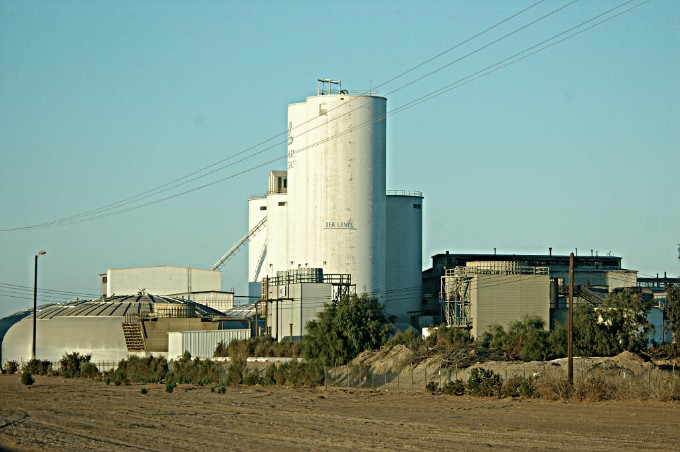
What does it say up on the round tower??
Let me put on a pair of binoculars.
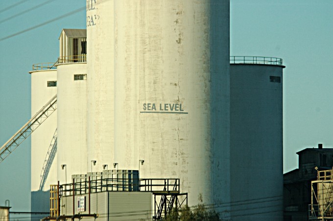
OH ME, OH MY,
that's what I thought it said.
How can this be I thought, am I driving under water?
Or, have I really gone down there, you know where I mean!!
I gotta stop the car, I gotta stop the car right now and pull over,
and get out my GPS, that is if'n it will work down here.
OH good I found it, now let's get it working.
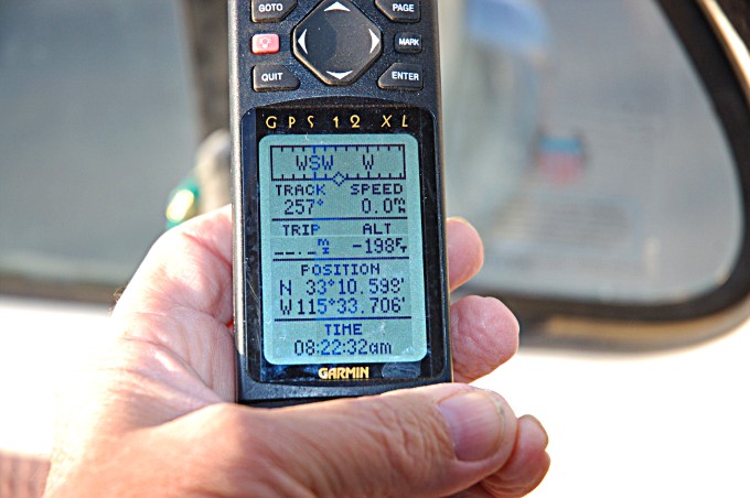
OH know, the sign was right.
I am 198 feet below sea level and I think it's getting hotter as I go.
Well as long as I am here I might as well keep on driving, and I did.
In a few more miles I could see much steam rising up from the ground.
That ain't good I thought.
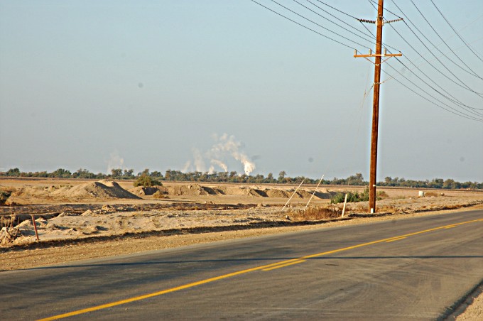
Is that steam or what??
And we all know steam is hot, and it's already getting hotter, and that ain't good.
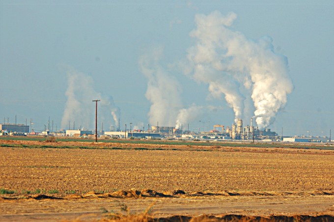
OH my, what is this?
I know there ain't notthin to cook out here so they must be mine'n steam from way down under.
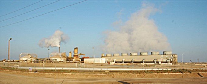
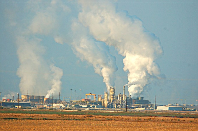
And here's another one 'o them steam mine'n plants.
I had better consult my Garmin GPS
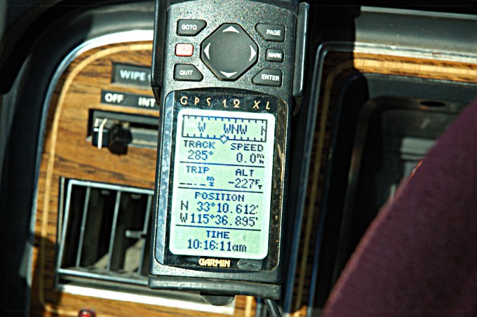
As you can see I am still going down, I am now some 227 feet below sea level.
How low can I go?
OH, maybe I spoke to soon?
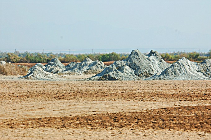
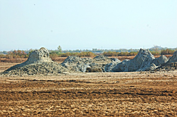
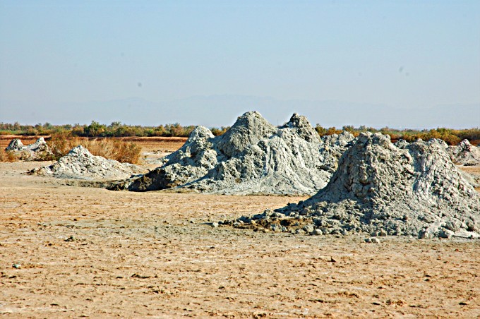
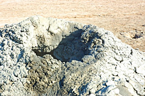
What are these things anyway??
Is that STEAM I see comin outa one O them mounds??
Better take a closeer look see, don'tya think?
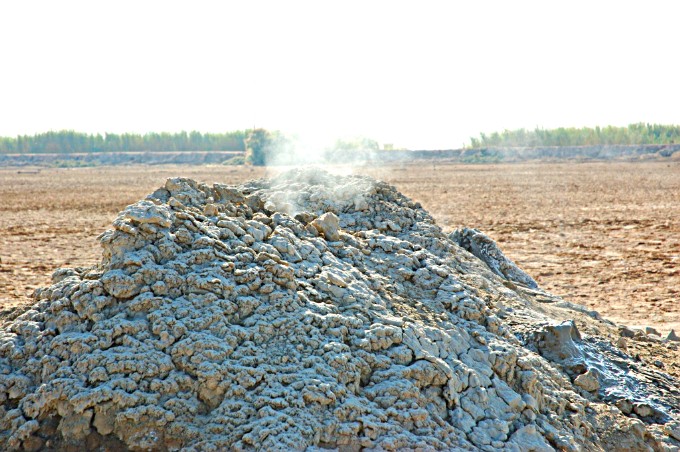
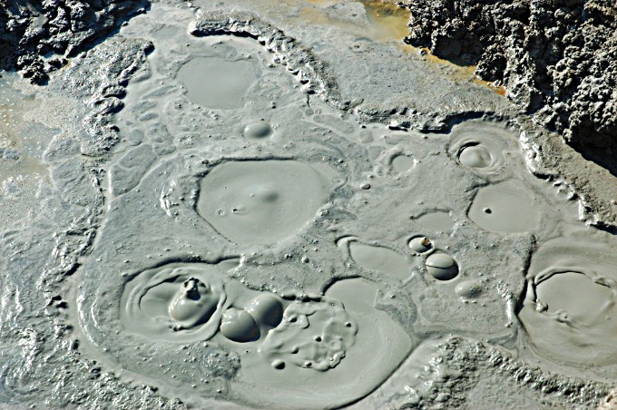
I just knew it, I just knew it was steam blowin up outa that hole in the top of that mound.
BRIM STONE, SULPHER, and all that bad smelln stuff from down below.
I told ya we went to HELL, oh IT MUST TRULY BE TRUE.
I jess gotta climb up there and look down inside that thing, OK?
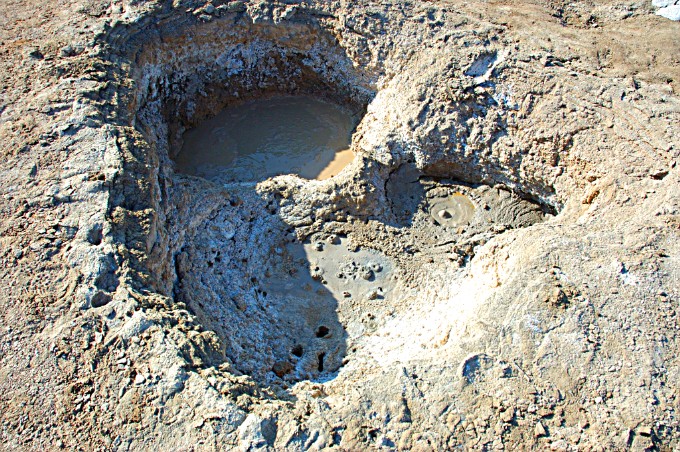
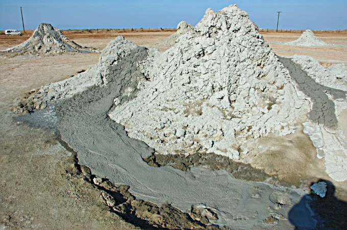
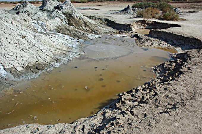
Boil'n hot mud from far down inside the earth.
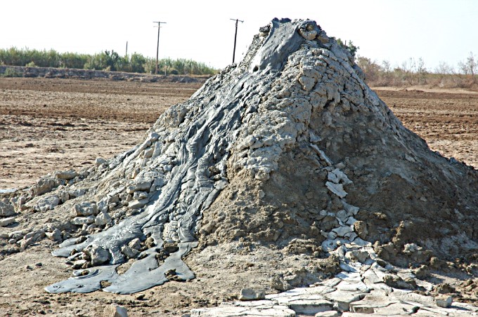
Look at this one the hot mud is ooooosing out the top.
This one is work'n over time.
I had better climb up to its hole and see what's in there.
Almost there, just a few more steps to go.
OH YUC. I think I had get down from here before I am covered with this stuff.
I better get outa here.
Belching mud, sink holes, I sink in several inches on every step I take.
Only Fools Tred Wheere Angels Fear to GO!
*****************************************************************
Well, as we all know I have gone to HELL just yet :-))
Photos 1 & 2 A grain elevater in Imperial, California high way 86 3 miles north of El Central
5,6,7,&8 are Geothermal Electric generating plants want to know more
http://en.wikipedia.org/wiki/Salton_Sea
http://seis.natsci.csulb.edu/VIRTUAL_FIELD/Salton_Sea/saltmain.htm
The MUD VOLCANOS
http://en.wikipedia.org/wiki/Mud_volcano
http://www.palmspringslife.com/media/Palm-Springs-Life/March-2006/Sea-of-Wonders/
http://epod.usra.edu/archive/epodviewer.php3?oid=257408
http://www.cfmsinc.org/fieldtrp/y2002/mudpots/mudpots.htm -- fotos of mudpots
All photos taken at the road into the south end of the Salton Sea Red Hill Marina
On or off Sinclare road or Garst road Mud Pots were on Davis road.
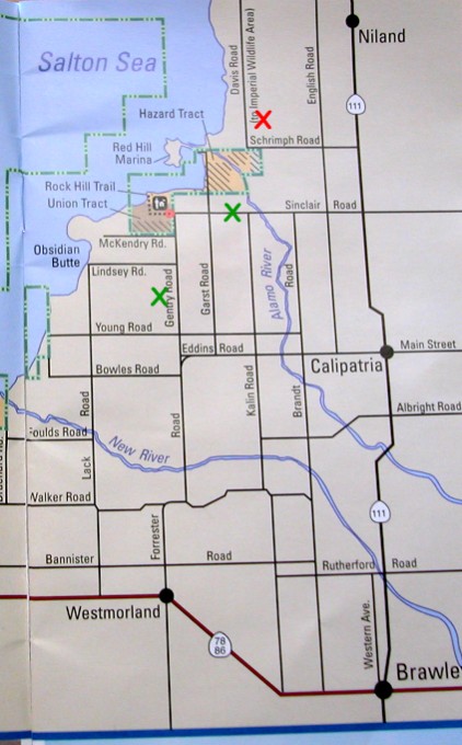
This is part of a map givin to me in order that I might find my way around there during my stay. I don't believe government stuff is copyrighted. If it is sorry I can/will remove it.
The red "X" is where the MUD POTS are
The green "Xs" are the locations of some of the generating plants.